")


first edition
1776 · London
by (AMERICAN REVOLUTION). (ATLASES - AMERICAN). SAYER, ROBERT and JOHN BENNET
London: Printed for R. Sayer and J. Bennet, 1776. First Collected Edition, Second Issue. 220 x 145 mm. (8 1/2 x 5 3/4"). 1 p.l., [v]-viii pp., [1] leaf, followed by maps.
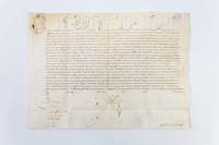
Contemporary marbled paper boards backed with calf, raised bands, spine gilt ruled, green morocco label. WITH SIX FOLDING MAPS (as called for), hand colored in outline. Armorial bookplate of "Henricus Liber Baro de Gudenus" on the front pastedown. Maps numbered along the reverse in a contemporary hand. Nebenzahl, "Atlas of the American Revolution" pp. 11-15, 61-63; Phillips I, 1206; Sabin 1147; Howes A-208; Streeter Collection 73. Extremities rather worn (as expected), boards slightly chafed; internally with faint offsetting to the maps, a handful of early repairs reinforcing the folds from the verso, map 4 with a small (wax?) stain, other trivial defects, but still probably qualifying as a fine copy--especially for its age and the use for which it was intended--the leaves and maps quite fresh, and the original unrestored binding entirely sound.
This is a particularly attractive copy of the so-called "holster atlas," published at the very dawn of the American Revolution to provide all the maps a British officer would need in the coming war. The atlas was issued by the print partnership of Robert Sayer (1725-94) and his former apprentice John Bennett after Sayer had acquired the plates, stock, and drawings of cartographer Thomas Jeffreys when the latter had gone bankrupt in 1766. The present atlas was intended to be taken into the field, "calculated in its Bulk and Price to suit the Pockets of Officers of all Ranks." (Advertisement) It was, in fact, widely used for this purpose during the war, consequently becoming known as the "holster atlas" since soldiers generally carried it in their holsters. The six maps it contains depict the British colonies in whole with a particular focus on "those which now are, or probably may be the Theatre of War." The maps include: "North America as Divided amongst the European Powers" and "A Compleat Map of the West Indies," both 1774 maps by Samuel Dunn; "A General Map of the Northern British Colonies in America" and " A General Map of the Middle British Colonies in America," both taken from surveys by Pownall and published in 1776; "A General Map of the Southern British Colonies in America" by Bernard Romans, 1776; and "A Survey of Lake Champlain" by William Brassier, 1762. These maps were selected with military strategy in mind: for example, when introducing the map of Lake Champlain, the editors indicate that its presence is due to the fact that "the Lakes Champlain and George form the Main Pass between the Maritime colonies and Canada." This is the second issue, probably released in November of 1776 (the first issue was in August); in it, the map of Lake Champlain includes updated information about the Battle of Valcour Island in October, useful information for its users in the field. Our copy is from the collection of Baron Heinrich von Gudenus (1839-1915), an Austrian nobleman with an extensive library. The "holster atlas" is not particularly rare, but, given its intended use on the field of battle, copies in agreeable condition are not easy to find.. (Inventory #: ST20199)